

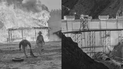
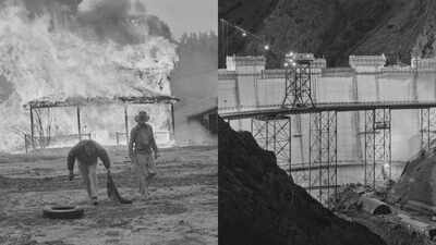
A small California community of ranches, farms, schools and family homes has been covered by water for nearly 70 years. Beneath the waters of Lake Berryessa rests the ghost town of Monticello, preserved in fragments: its roads, foundations and historic bridge still visible beneath the surface while photographs and memories keep its story alive above. The town was flooded as part of a massive water project in California but its legacy has been much harder to wash away. According to The Sacramento Bee, in the 19th century Monticello grew up on Putah Creek in Napa County, and eventually was home to some 300 people. They farmed, raised cattle and created a close-knit rural community in the Berryessa Valley. That life changed in the late 1940s, when the plans moved forward for the Monticello Dam and the reservoir that would be Lake Berryessa. The government bought the land for the project and evicted the residents of Monticello. By 1956, buildings were being destroyed or burned so they would not become hazards when the valley flooded. The dam was finished in February 1957 at a reported cost of $47 million. Soon the valley began to disappear beneath the swelling reservoir, which would provide a major water source for Solano County.
What was lost at Lake Berryessa
Monticello had more than houses. It had businesses, schools, farmland, community facilities and a popular rodeo with the Scribner family. The valley was also known for its fertile soils that supported cattle, wheat and other agricultural activities. Later, Highway 28, later Highway 128, crossed the southern end of the valley. In 1896 a stone bridge was constructed across Putah Creek joining parts of the community. Much of the land is still under water. During droughts and low lake levels, pieces of the old town have occasionally surfaced, offering a rare glimpse of what was there before the reservoir. The historic bridge has even attracted scuba divers exploring the underwater landscape, states the Sacramento Bee report.
Monticello photographs saved
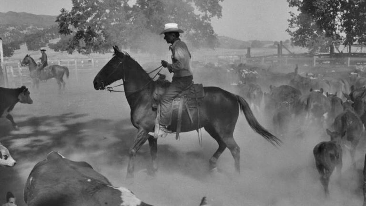
The photographs came to be known as Death of a Valley. Life never published the full project but excerpts were published in the magazine Aperture in 1960.
One of the most striking accounts of the town’s last days came from the photographers Dorothea Lange and Pirkle Jones. The couple spent a year on assignment from Life magazine photographing Monticello and the nearby Berryessa Valley as the residents prepared to move away. Their photographs documented houses, farms, families and landscapes on the verge of extinction. Lange was a celebrated documentary photographer, known especially for her famous photo of Migrant Mother. Jones had been an apprentice of famous landscape photographer Ansel Adams. The photographs came to be known as Death of a Valley. Life never published the full project but excerpts were published in the magazine Aperture in 1960. Decades later, UC Santa Cruz digitized thousands of images from the collection and put them online, letting a new generation see the community that is now under the lake.
Painful legacy for former residents
The loss was more than just the vanishing of buildings for families connected to Monticello. Former residents were dispersed throughout neighboring communities and some could find no affordable farmland to replace what they lost. Families that had lived in the valley for generations suddenly had to re-create their lives somewhere else. It was one chapter in a much larger story of American displacement. Hundreds of communities across the U.S. have been abandoned or submerged due to dam and reservoir projects. Monticello’s experience is a case study of the human costs of infrastructure decisions that can remake entire landscapes while serving populations orders of magnitude larger.
Remembering a lost community
The Monticello Public Cemetery was moved before the reservoir was filled, and is now located near Spanish Flat. With some 600 graves it has become one of the most tangible reminders of the former community. Descendants still gather there, particularly around Memorial Day, connecting families whose hometown disappeared generations ago. The number of surviving residents has steadily declined, making those reunions more and more important. Today Lake Berryessa means recreation, water supply and California’s vast infrastructure network. But behind the front was another story: a town whose houses had been razed, whose valley was flooded and whose residents had been scattered. Monticello might be invisible on the landscape, but its photographs, cemetery, sunken buildings and remaining family memories make sure the community has not totally gone.Images Courtesy: The Sacramento Bee